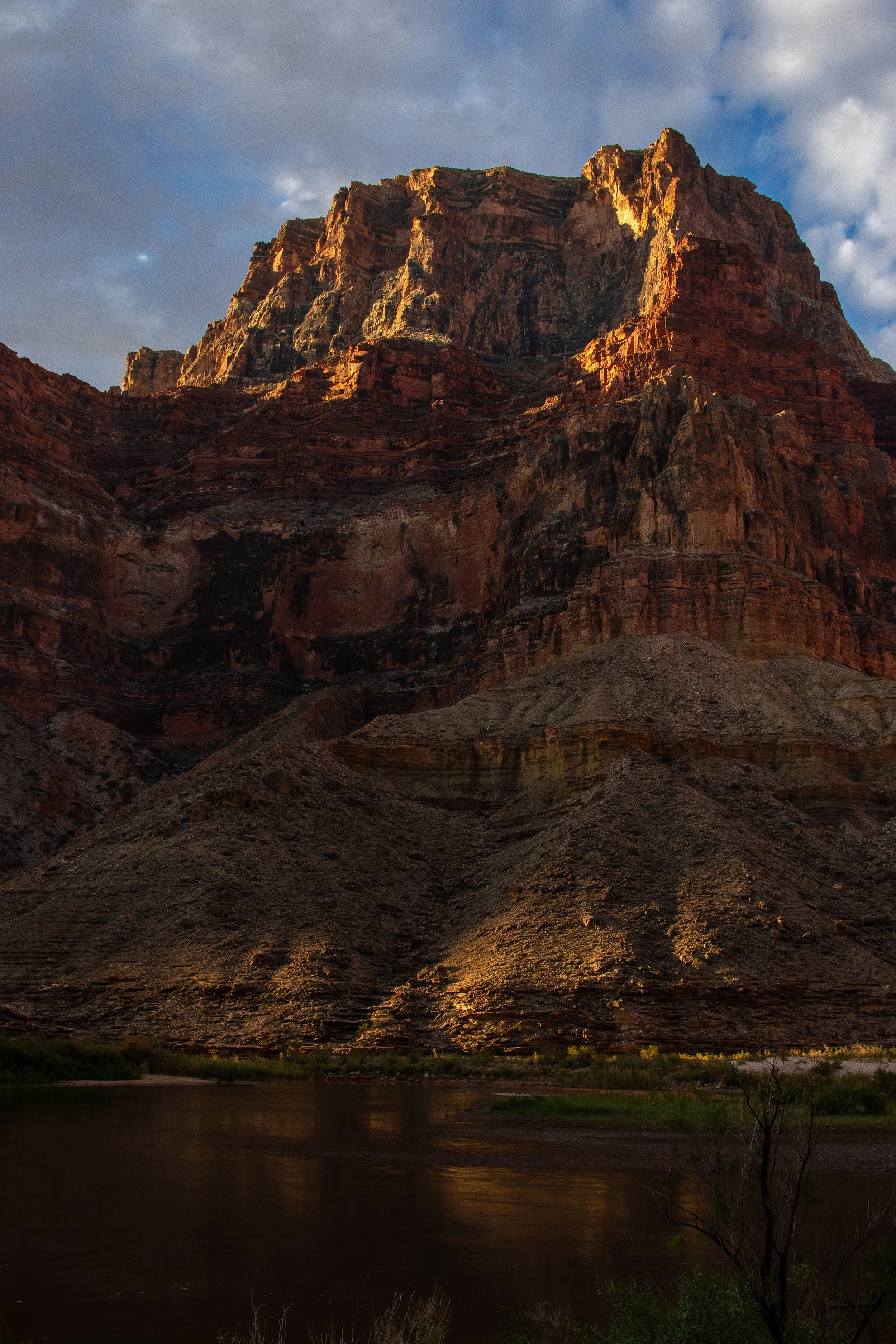
Every trip down the Colorado River through the Grand Canyon takes weeks, if not months, for me to fully process. So much happens in 20 days. I keep a journal, writing every night on the river about my day, what work I did, what was hard, what was beautiful, what was hilarious. From August 26-September 14, 2026, I completed my sixth trip, this one with USFWS as a volunteer for the Colorado River Mainstem Fisheries Aggregation Project. We spent twenty days collecting data on the fish populations in the river, both native and nonnative, as part of ongoing population monitoring to inform management decisions for Glen Canyon Dam, the Grand Canyon, and the Colorado River system more broadly (more on that in a future post).
As part of my re-entry into the Rim World, I often re-read my journal entries. I noticed that I often wrote about my rain jacket, which got plenty of use on this trip, in addition to the wild weather we dealt with. During the first week, it rained nearly every day. It was full-on monsoon season in the Canyon, which meant all sorts of shenanigans and struggles. So, the following is a collection of stories from the trip, all related to the glurp, the rain, and the flood.
THE GLURP
We had just launched on the morning of August 27th and the water was crystal clear at Lee’s Ferry, only a few miles below Glen Canyon Dam. We knew that a ton of rain had fallen in the desert over the Paria River, and as we were driving along the road up to Lee’s Ferry we could see that the tributary had blown out and was running a khaki light brown. Once we were heading downstream, our boats met the Paria where its muddy waters mixed and churned with the clear Colorado, and we knew with all the rain that Northern Arizona had been getting, that we wouldn’t have clear water for the rest of the trip.
As we lamented in the reality of our next three, muddy weeks, the 22-foot snout boat that we would be using for seining ran up onto a sandbar just downstream of the mixing water. Ran, the retired fisheries biologist who was a USFWS and river-running legend, put the motor in reverse and tried to back off the sandbar. We were stuck. He tried to “waggle”, where in forward gear he pointed the motor all the way to the left on full throttle, then all the way to the right on full throttle, moving back and forth, trying to wag the boat and loosen its suction on the sticky, muddy sediment from the Paria. No luck. We had only been on the boat for maybe ten minutes! Pilar, the Principal Investigator of the trip from USFWS, and Kenai, Ran’s son who had been on many fish trips, and I laughed at our misfortune, then hopped off the boat in the shallow and swift running water in the middle of the river to try to push the boat off the sandbar while Ran kept waggling and switching between forward and reverse. Eventually we were able to get the angle just right, where the motor was out of the shallows and the front of the snout was in the current, and we broke free and continued on downstream.
Pilar and I both had bruises on the tops of our shoulders for the next few days from lifting up the heavy side tubes with our shoulders, and pushing up and out with our legs, trying to get the boat off the sandbar. A well-earned battlescar…
While the boats got stuck a few more times over the next 20 days, none were quite as stuck as the snout boat was that first day, but the muddy tributary water of the Paria and other side canyons continued to haunt us for the rest of the trip.
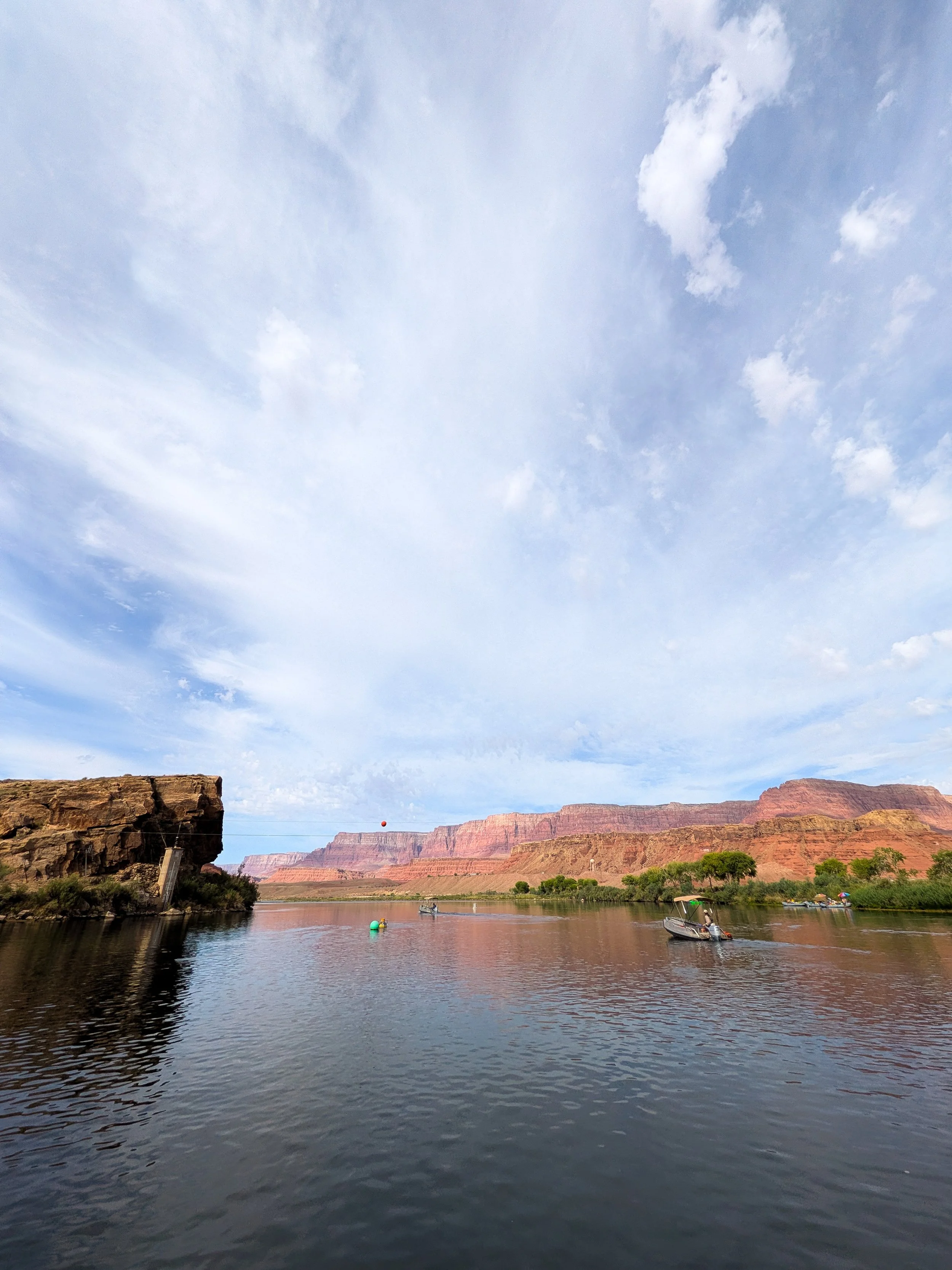
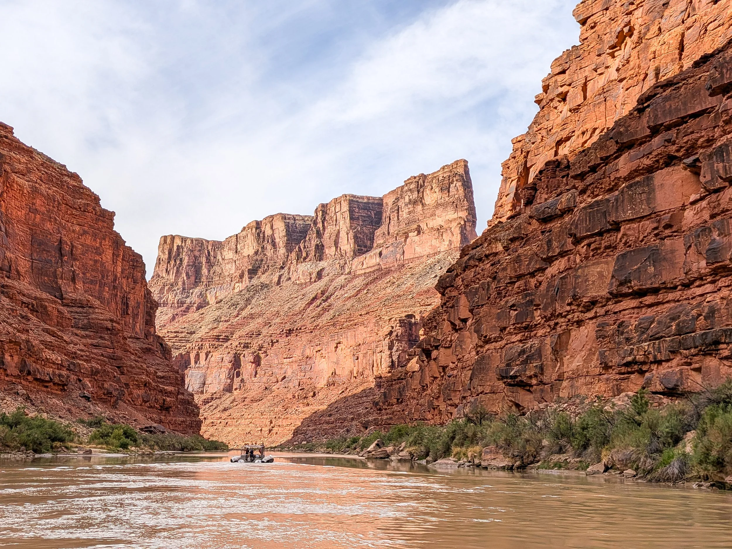
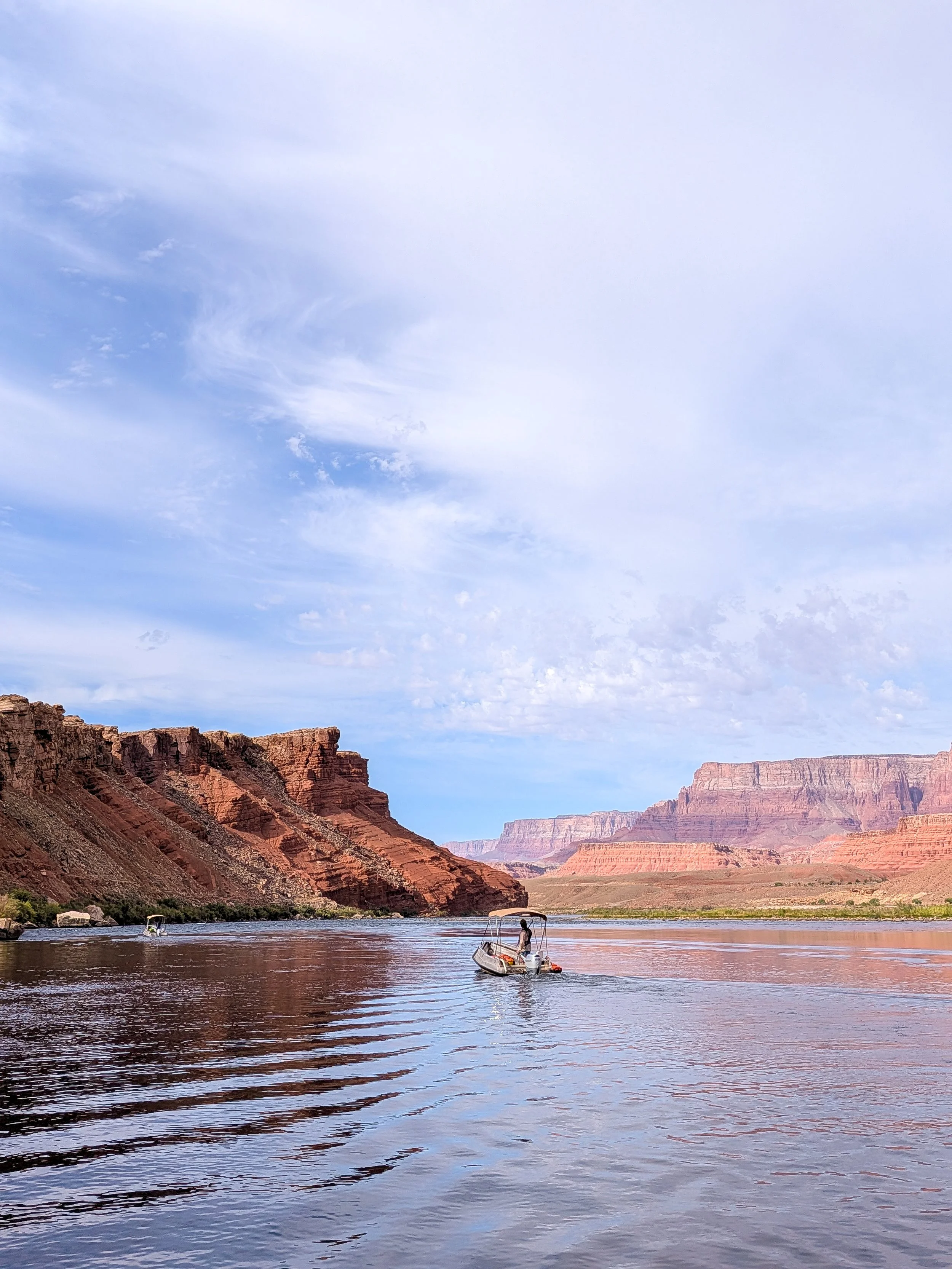
The Colorado River, before it was dammed, was famous for being reddish brown and “too thick to drink and too thin to plow”, as it and its many tributaries cut through the red-rock desert of the Southwest to the Gulf of California. Since building dozens of dams along the river in the early to mid-1900s, sediment flowing through the Colorado has been trapped behind the dams, leaving the river to flow unnaturally clear.
On my previous river trips, the river has been clear or close to clear. Last year on my trip with USFWS, the Dragon Bravo Fire on the North Rim burned through many side canyons, which when flooding after the monsoons, deposited black ash into the mainstem, turning the river dark brown and almost black. This year, the river was so muddy you could never see through it. It was truly the red, brown, muddy, chocolate milk-like Colorado River in all its glory.
Turbidity, or the clarity of water, is measured in NTUs (Nephelometric Turbidity Units) and changes based on the amount of material suspended in the water like sand, silt, clay, organic and inorganic matter. USFWS measures turbidity twice per day on these trips, a factor that can impact our catch rate (we generally catch fewer fish when the river is muddier, or more turbid). For comparison, a clear trout stream has a turbidity of anywhere from 10 to 50 NTU. Last year, when the river was running black from the ash, it was 600-1,000 NTU, which I thought was crazy at the time. This year, we measured turbidity of up to 40,000 NTU.
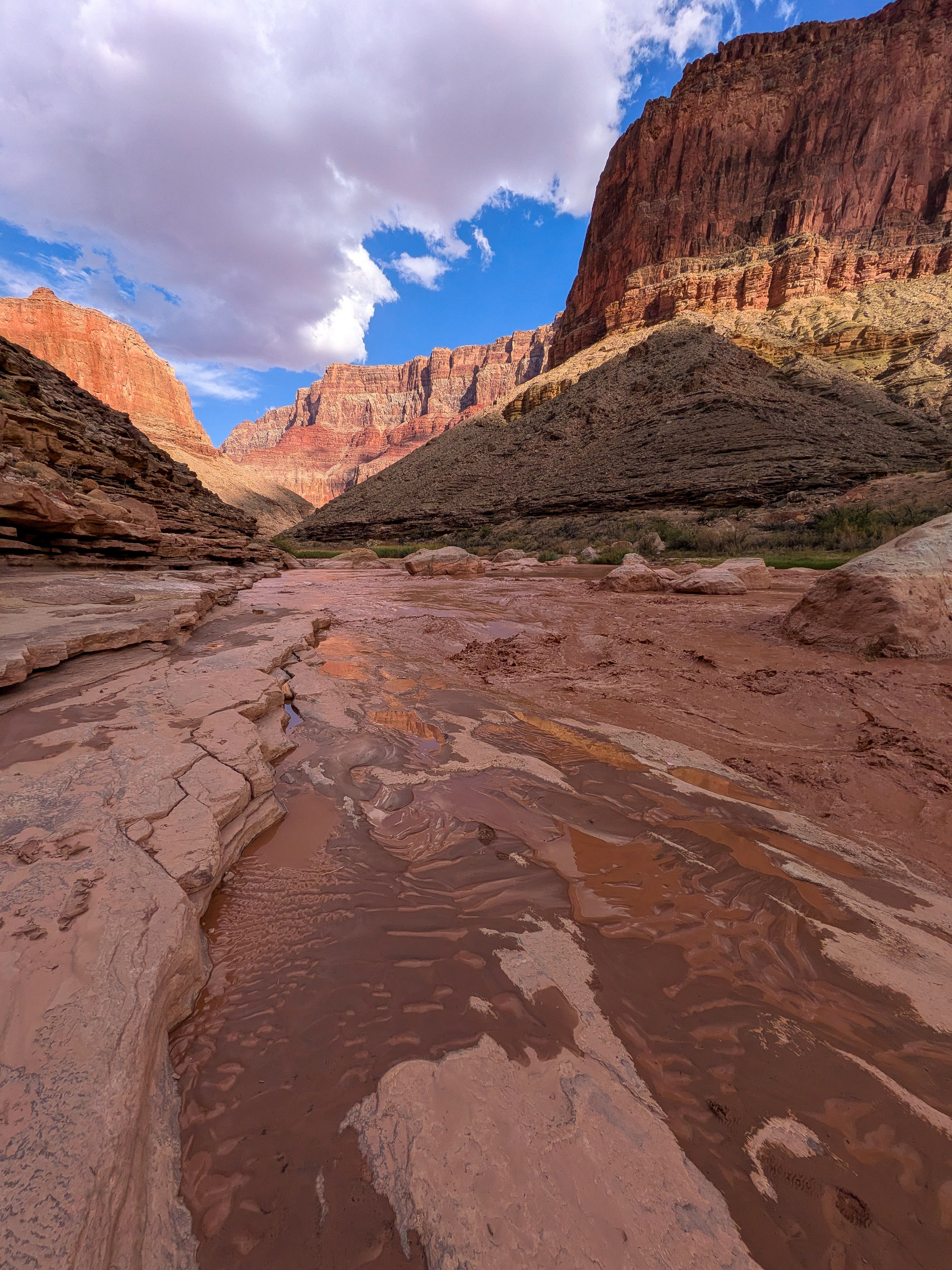
The muddy waters of the Little Colorado River.
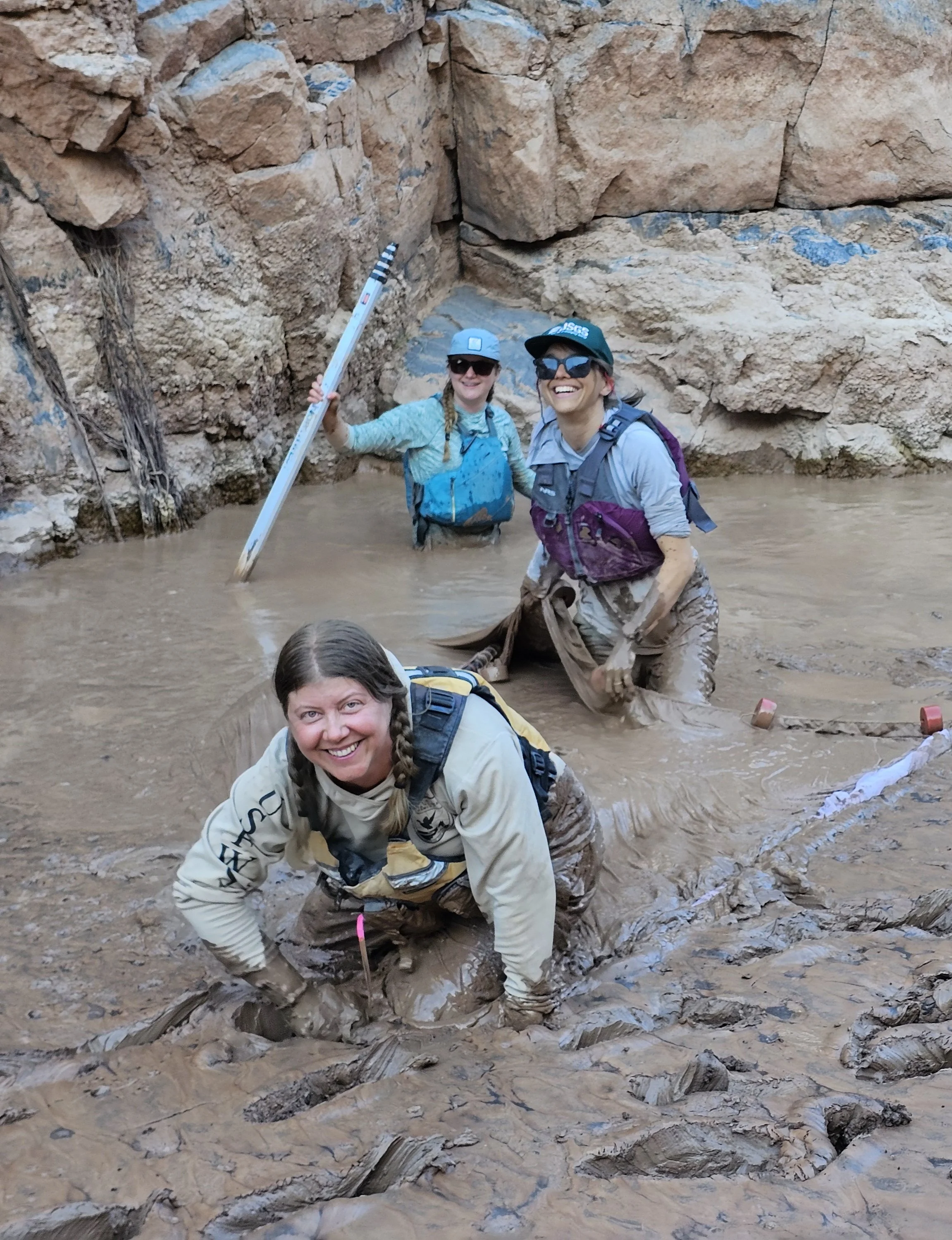
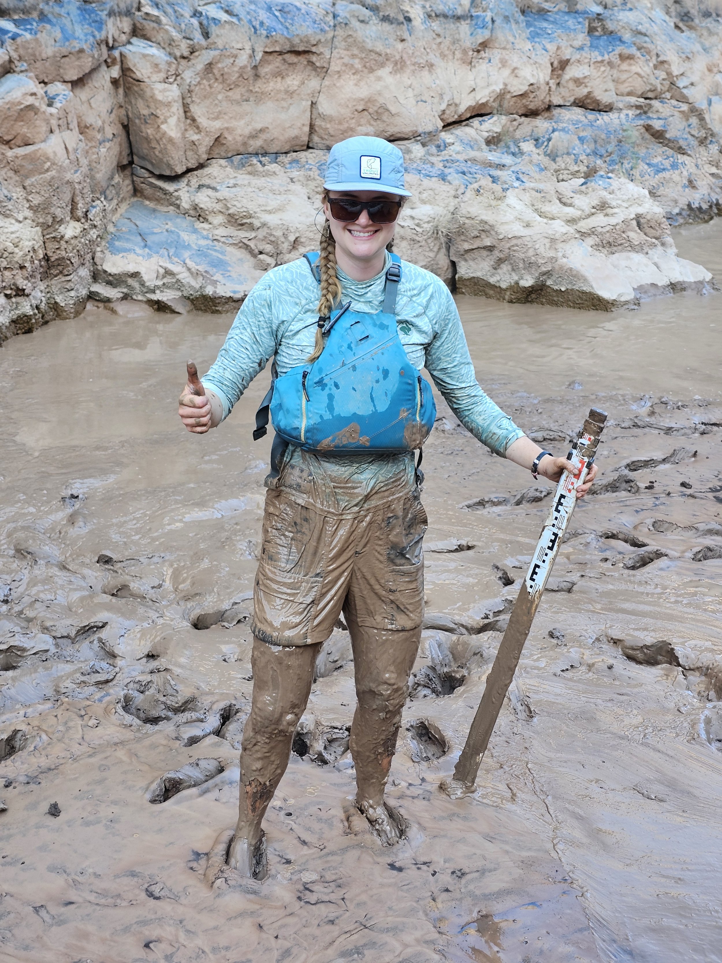
All of that suspended material was flowing into the mainstem from the many side canyons that were running high from the monsoon activity on and near the Rim. It all has to settle somewhere, and in the Grand Canyon, it settles into “sandbars”, like where the snout rig got stuck on Day 1, and into what the scientists call “glurp holes”. A glurp hole, full of glurp (a truly scientific term), is the muddy, sticky, quicksand that builds up along the banks. The glurp is what your shoes get stuck in when you pee in the river and what you slip and slide on as you unload gear off the boats. The glurp sticks to your shoes when you get back on the boat, and you leave behind a trail of glurp on the side tubes, making the rubber walking surface extra slippery for everyone else. The glurp is what you sink into, when seining a backwater or tying a hoop net to a bush along the banks. The glurp becomes a part of life on the river.
I’ve experienced glurp before in the Grand Canyon on these trips, but this year was the first time I’ve truly understood the struggle of trying to seine a glurp hole. On Day 5, we were just below the Little Colorado River (LCR), which was running thick and muddy, where we seined a backwater that had glurp that was two feet deep. I slipped my Chacos off to avoid losing them in the suction of the glurp (a strategy we used all throughout the trip, and tried not to think about the possibility of stepping on something sharp or metal), and tried to pull the net through the glurp hole barefoot as I struggled through waist-deep mud. Somehow, we caught 25 fish. Those young-of-year flannelmouth suckers and humpback chub were made for thriving in a desert river full of glurp. My new cream-colored OR pants though, were stained reddish brown from the glurp and will never be the same color.
On Day 9, I helped seine a glurp hole that was an absolute nightmare. We were just downstream of Deubendorf Rapid around River Mile 133. The river’s turbidity was at 9,000 NTU that morning, so not the worst we’d seen, but still chocolate milk. We measured the backwater’s depth to be just an inch, but it turned into a bottomless pit of thick, suction-y glurp once we waded through it with the seine. My friend Tiffany and I couldn’t get the 12-foot seining net through the water, it was quickly laden with glurp and was too heavy for us to move while we were stuck, unable to move ourselves. We were halfway through seining the site when we decided to abandon ship and save ourselves from the glurp hole. It was exhausting moving through the glurp to get back to stable land, like trying to walk through a foam pit, but all the foam is heavy, sticking to your clothes and sucking you in. When I finally crawled out of that glurp hole, my clothes were completely covered in mud, and I was exhausted and starving. Glurping makes you hungry.
The extreme turbidity also made it hard to bathe. Anytime you’d emerge from the River to cool off or rinse the glurp off, you’d feel refreshed and “clean” but know that the clay and silt was still there, in your hair and in every crack and crevice.
I tried to keep my hair out of the river as much as possible. But on Day 4, I decided it was time to wash it, especially since we were just above the LCR and knew that the river would get way more turbid once we were below it. I filled a bucket with water and told BJ, one of the boatmen, to store it untouched on the boat for me all day so the silt would settle at the bottom, leaving me with clean-ish water to wash my hair in at camp that night.
Once at camp, BJ told me that the boatmen had filtered drinking water that day for us while we were out working, and that instead of my settled water, he had some leftover clean filtered water for me to wash my hair with! I was ecstatic, and rinsed and washed my hair in the bucket.
I was trying to comb my hair afterwards, when I realized something was way off. My scalp was sticky and I had been working knots out of my hair for ten minutes and was frustrated that for the life of me, I couldn’t get a comb through it, no matter how much product or oil I put in it. I then realized that the boatmen had added alum, or aluminum sulfate, to the water before filtering it. Alum is a chemical coagulant that you can add to turbid water to bind fine particles together into larger clumps, making it much easier and faster to filter since it causes all the sediment to settle out. That alum was now in my hair and on my scalp, and left a sticky residue that seemed to attract silt and clay. I couldn’t rinse it out, and it was only Day 4.
After that, anytime we passed a spring that had clear water, or anytime we found a waterfall and had a chance to take a high-pressure rinse, I stuck my head under it, trying to get the alum and river sediment out. At Travertine Falls at River Mile 229, over 150 miles and ten days later, I sat under the clear flowing water for a while and finally that night, to my surprise, I could get a comb through my hair. I laughed with the other scientists at BJ’s best intentions to help me out, and warned others not to trust any water the boatmen give you for hairwashing.
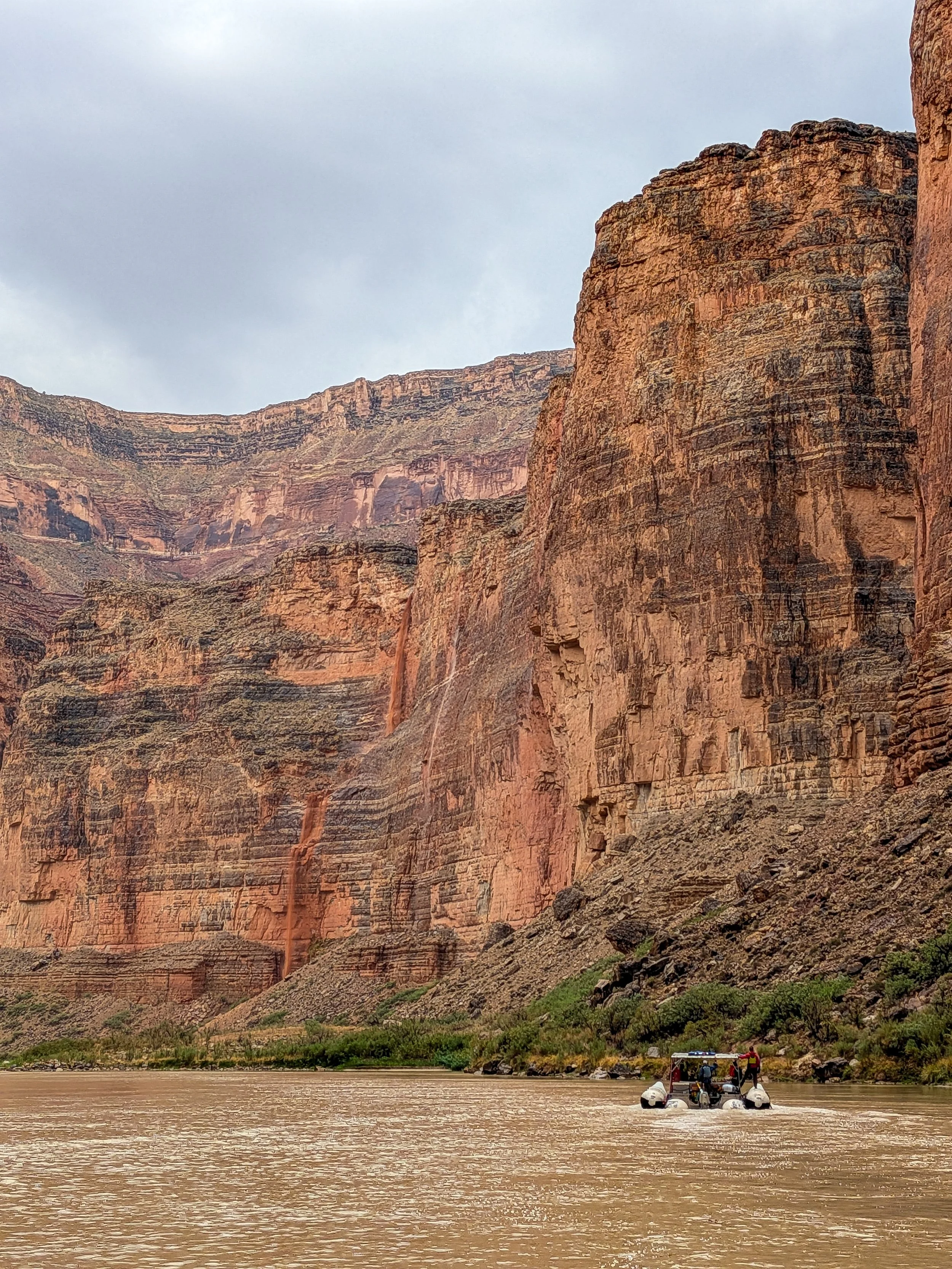
Waterfalls flowing off the Redwall Limestone, near President Harding rapid, River Mile 44.
THE RAIN
For the first week of the trip, it rained nearly every day. I spent more nights in my tent on this trip than I have on my five other trips combined. I usually despise sleeping in a tent in the bottom of the Grand Canyon - it’s absurdly hot, sweaty, and has no air flow. But even worse is waking up in the middle of the night to rain drops, and not being able to sleep through the anxiety of a storm hitting in the middle of the night.
So this year, because it was raining so frequently during the day and into the evenings, I’d set up my tent anytime there was a chance of rain. I got pretty good at staying cool in my tent - I left the doors and rain fly open to maximize air flow, and would only close them if there was an actual downpour. It was comfortable sleeping in my tent with my paco pad on the ground, rather than in a cot. I didn’t have nearly as much anxiety through the night.
In fact, there was only one night that the rain took us by surprise. At 3am on Night 15 at a camp in the Lower Granite Gorge, it started sprinkling, and everyone woke up, turned on their red lights, and headed to the personal gear pile at the same time to grab tents. It was miserably hot in the Gorge that night, so hot I couldn’t sleep, so twice during the night I wet my sarong to lay over me for some evaporative cooling. When I felt the rain drops, I merely rolled over to pull my rain fly out of my tent bag and set it next to my head. I was willing to get sprinkled on if it would cool me off, and if it really started raining, I decided I would just pull the rain fly over my cot like a waterproof sheet. But it never rained and so I continued to sweat and barely sleep all through the night.
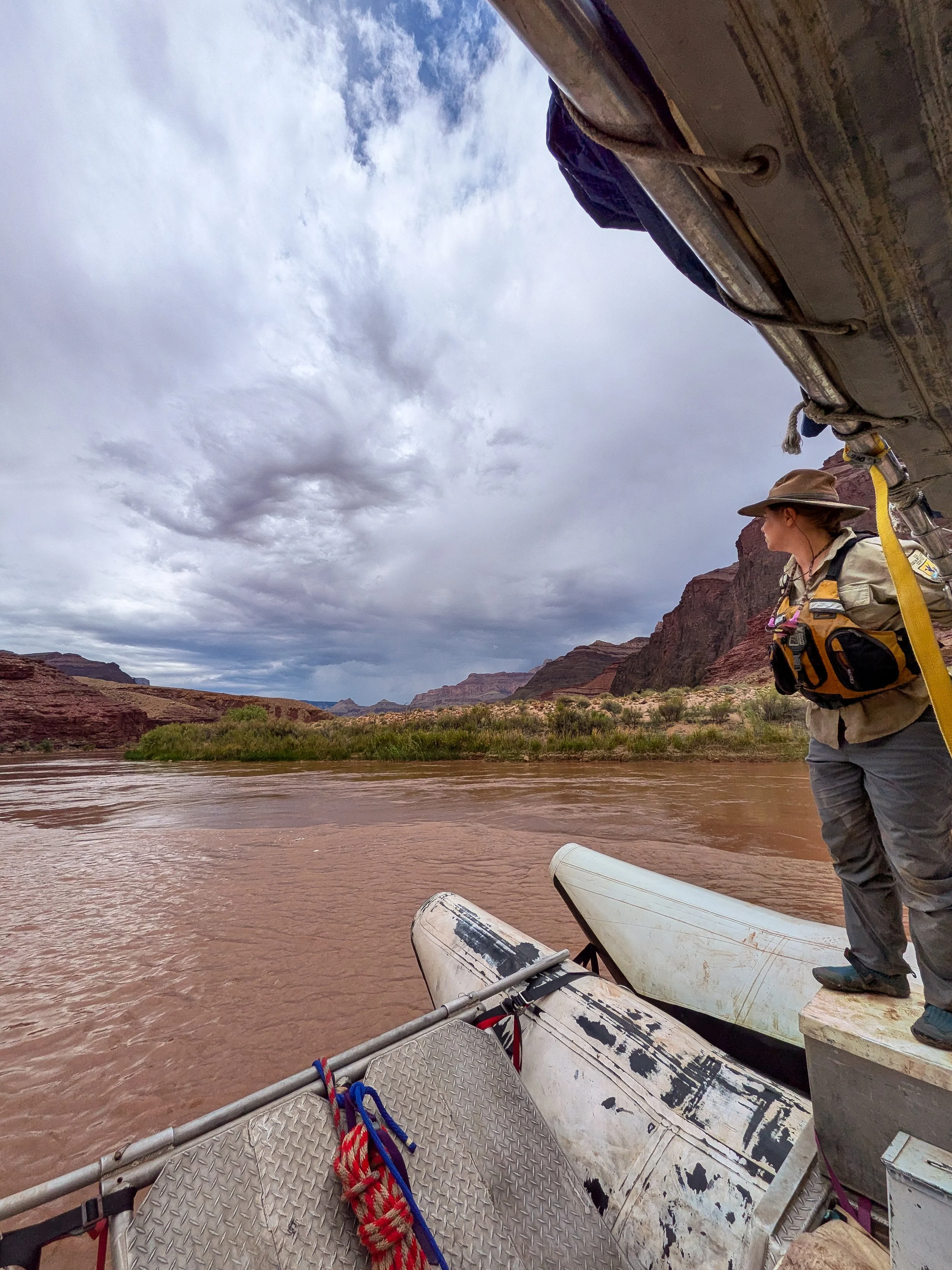
Upstream of the LCR, it rained a ton. On August 29th, Day 3 of our trip, I was riding on the kitchen boat but was helping the seining crew. We stopped at a backwater, and right after pulling up the seine with a few hundred fish, it began raining hard. I was sitting on the seining boat under the bimini with the computer while the seining crew was on shore counting fish under a small umbrella. It was nearly raining sideways as I was entering data into the computer and trying to keep the screen dry, and the seining crew had to nearly scream data, numbers, species, and other information to me so I could hear them over the sound of the rain hitting the bimini. We looked up about halfway through counting the fish in the bucket to see a waterfall flowing over the top of the Redwall Limestone above us. And downstream, there were a few more waterfalls flowing, each hundreds of feet tall, with red water rushing over the cliff and into the river. It was beautiful.
It rained on and off for a few hours while we seined a few other sites. We found lots of nonnative fish that day - carp, sunfish, shad, and even two really tiny unidentifiable fish (under 20 mm) that we were suspicious to have been smallmouth bass. We preserved them in ethanol to be identified in the lab once we got back from the trip (while I was writing this, Pilar told me she hasn’t yet gotten the species results back from the lab).
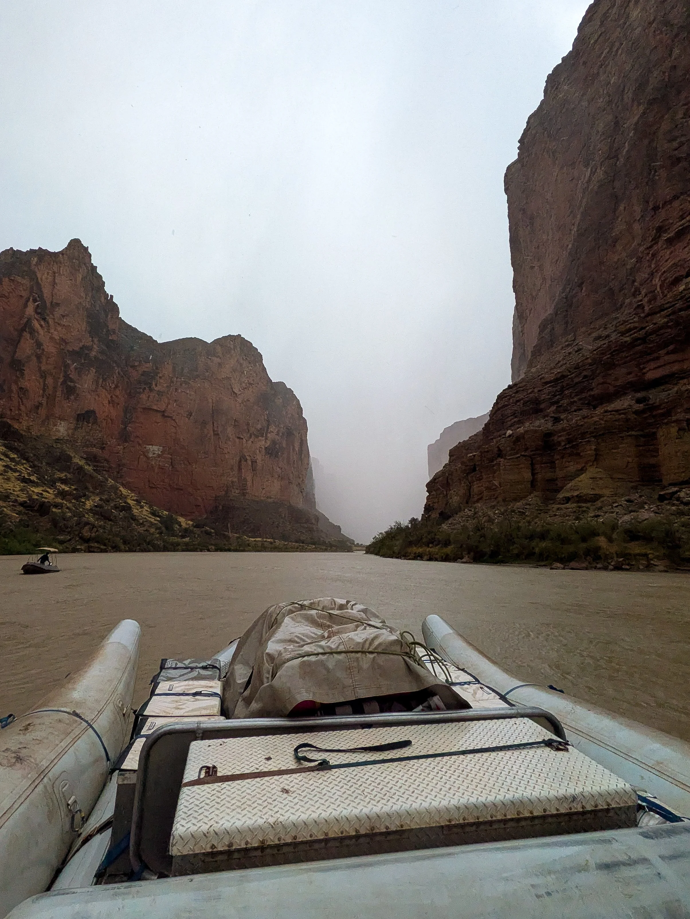
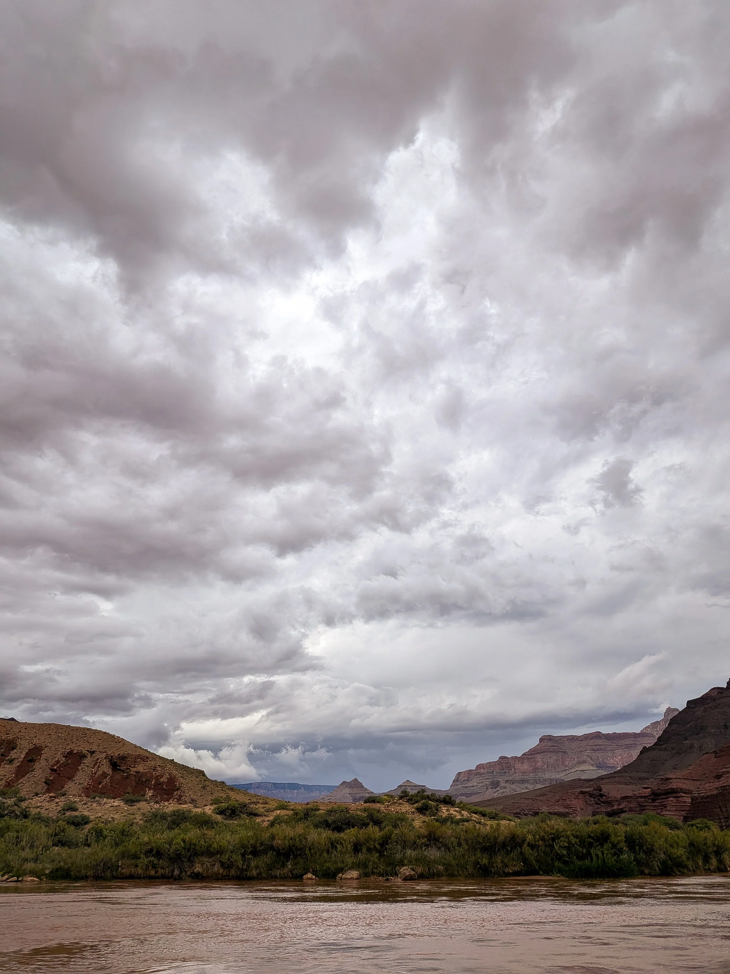
Later that afternoon, we were just below President Harding Rapid at River Mile 44 when dark stormy clouds were swirling above us and lightning was flashing everywhere. We rounded a corner in the river, and lost all downstream visibility to a wall of water moving up towards us quickly. Jeremy, our trip leader, told us all to pull over and brace ourselves, “that sh*t is nasty!!” he yelled and we didn’t need to be driving through it.
The rain started to hit us sideways as the boatmen parked and I climbed into the motor well and put up a Sunbrella for a makeshift shelter. I was already soaked. It was a torrential downpour. It rained violently. They were raindrops the size of quarters and it did not stop for 15 minutes while we huddled under the umbrella. I could barely see out the side of the umbrella, and between the rain and the river I couldn’t tell what was water and what wasn’t.
Once the rain finally lightened and I emerged from the motor well and the rest of the crew stood up on the boats, we were all amazed at the dozens and dozens of waterfalls flowing off the Redwall, all rushing down into the river. That was a storm to remember.
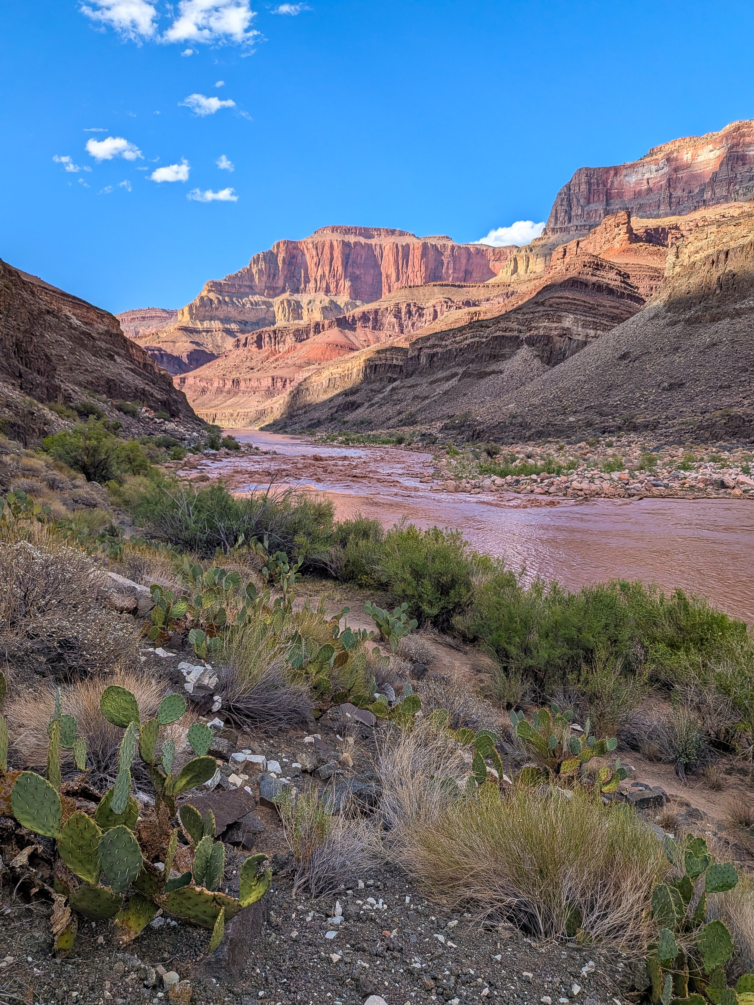
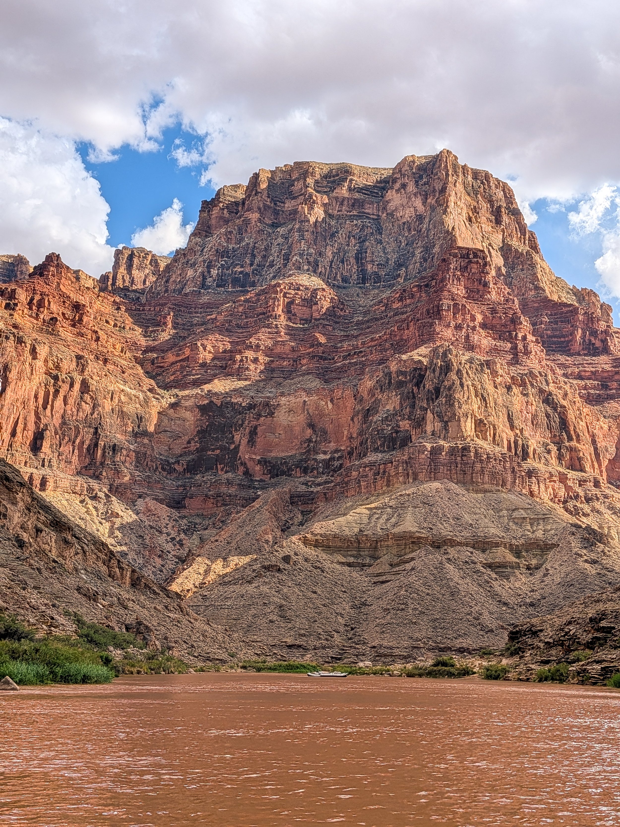
Dubendorf Rapid, River Mile 132.
THE FLOOD
At camp that night on August 29th, we were just below Dinosaur around River Mile 50. We were eating burrito bowls for dinner when we got a text from the Park Service saying that a storm had dropped 2 inches of rain in an hour on the Rim above Bright Angel Creek and that it had flash flooded. NPS said the Colorado River was closed at Phantom Ranch, and that all parties would have to pull over to talk to park rangers. The flood washed two foot bridges into the river, and created a new rapid. A few of our trip members got texts from friends over the Starlink, saying that the gauge where Bright Angel Creek meets the mainstem had reached 30,000 cfs, which we knew wasn’t possible, as the mainstem Colorado was flowing between 6,000-9,000 cfs. But the flood must have blown out the gauge. They sent us videos, the flood was shocking.
We knew that the violent storm that hit us earlier that afternoon near President Harding was responsible for the flash flood. But we had no idea the extent of the damage or what any of this meant for us. I sent my parents a text from my inReach to let them both know I was okay.
The next day, August 30th, we got more information from friends. The Bright Angel Creek flash flood destroyed Phantom Ranch. The NPS had lots of construction equipment down there for various maintenance and infrastructure projects, lots of which had apparently washed into the river. Dozens of people were unaccounted for, likely hikers who had gotten caught in the flood, since the Bright Angel Trail is the most traveled trail system in the Canyon. But the NPS had opened the river back up with “mandatory” scouting of the new rapid for all river parties, and told us to watch for metal debris in the river. The flood made national news, and a few trip members read the headlines to us.
I usually make a point to keep my phone off on river trips, and having Starlink where the crew can turn on their phone to check in with friends and families is a new feature for me in the Canyon. I find the silence from the Rim world to be one of the most rewarding parts of the river experience. But with all this going on, I decided to turn on my phone and connect to the Starlink to let people know we were safe. It was really nice to have it.
At this point, we were still two days upstream of Phantom Ranch. The boatmen all seemed a little rattled with the idea of a new rapid, and we were all freaked out about the idea of dozens of missing people that could be floating somewhere in the river. But we had work to do, so we all put our heads down and continued on.
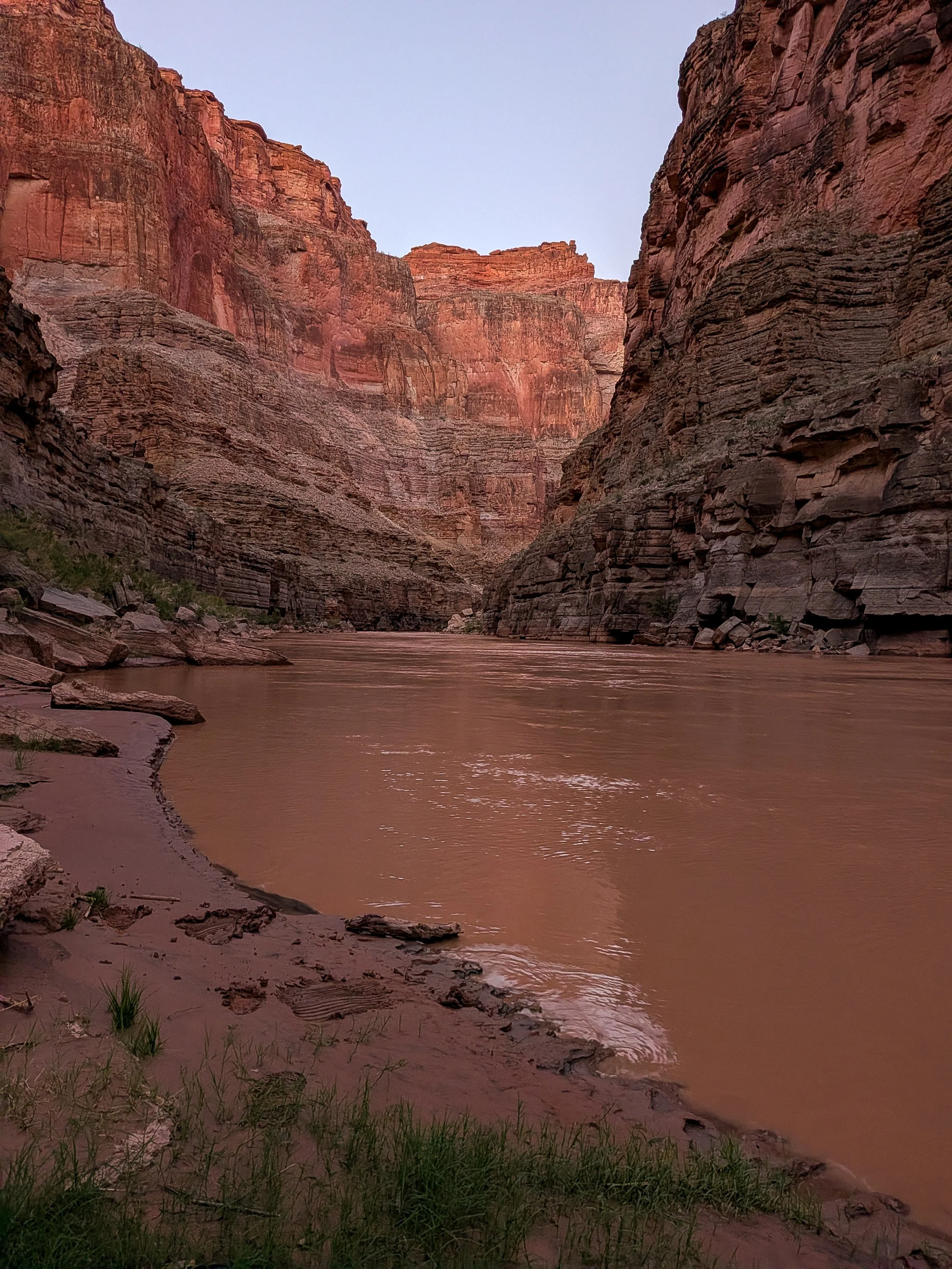
Last Chance Camp above Havasu, River Mile 156.
Two days later on September 1st, we reached Phantom Ranch. When we were pulling in, we noticed that the river had actually backed up from the new rapid as the water was way higher, submerging the vegetation along the banks. We tied off the boats and headed up towards Bright Angel Creek to scout the new rapid.
The devastation was shocking. The creek was muddy red and there was debris everywhere. My jaw dropped as I looked over piles of boulders the size of cars, full trees, logs, branches, rebar, pipes, scraps of metal, planks, 2x4s, a backhoe, other trash, and construction material that lined Bright Angel Creek. The sand and mud was still wet, but it was like concrete, with everything frozen into place. A helicopter circled above us. It was eerie. We walked up the creek a little ways towards Phantom, looking for a place to cross, when a NPS ranger stopped us and yelled, “You can’t come up the creek any further! There’s a cadaver dog up there, and your scents will throw him off!”. We nodded and turned around solemnly, heading downstream to the new debris fan.
The new rapid was substantial, with two big pieces of unknown metal objects sticking out on either side, but the line down the middle looked completely do-able. We watched a commercial trip run the rapid and made it look pretty easy. We waved as they went by, they never stopped to scout. As we turned back up Bright Angel Creek to head to the boats, I noticed dog prints in the sand all around us.
Luckily, we never found any bodies. We saw an NPS helicopter and two rangers on the side of the river just above Granite, and assumed they found something, but as the weeks went by we learned over the Starlink that the number of missing people had dropped to three, and eventually the NPS recovered several bodies.
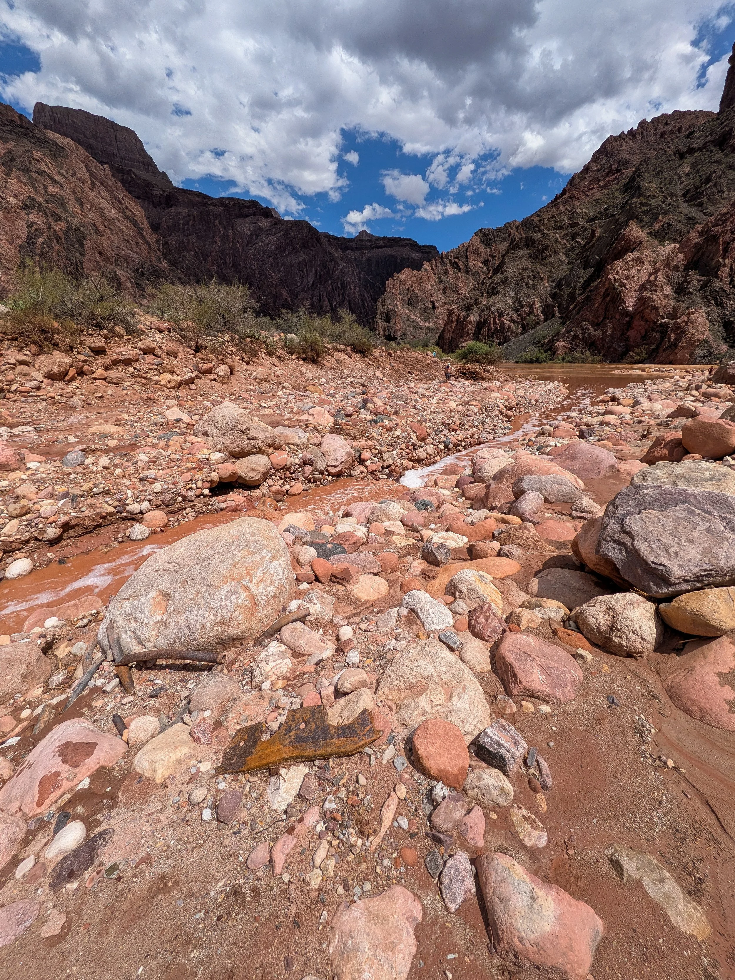
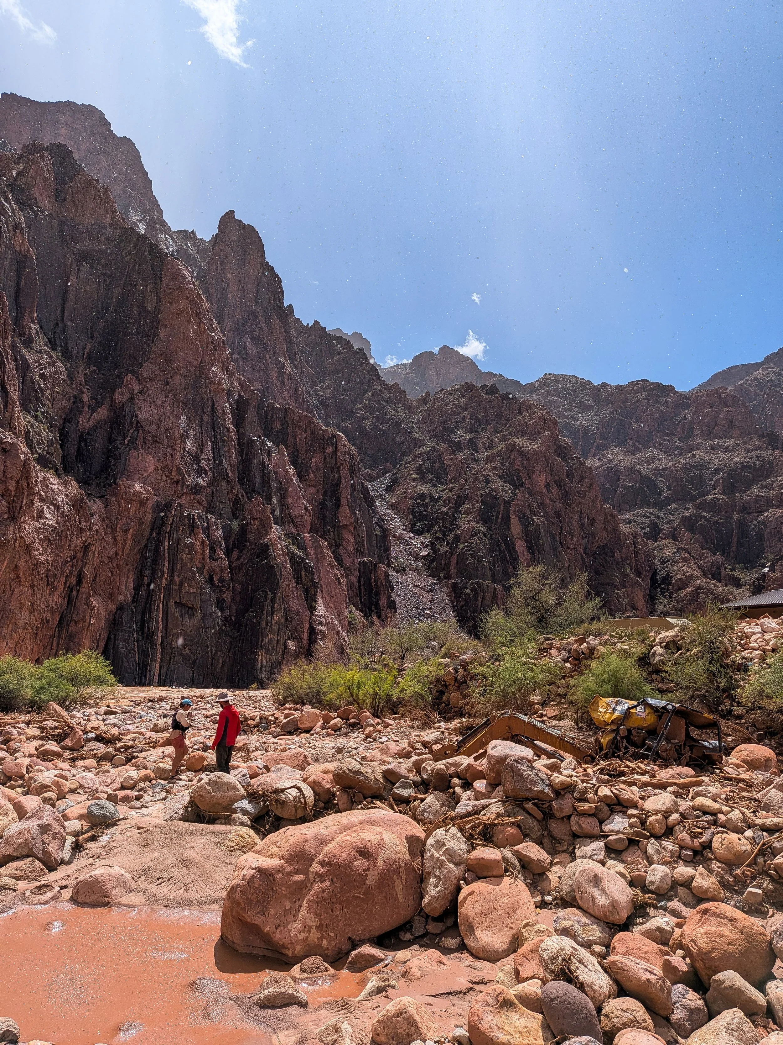
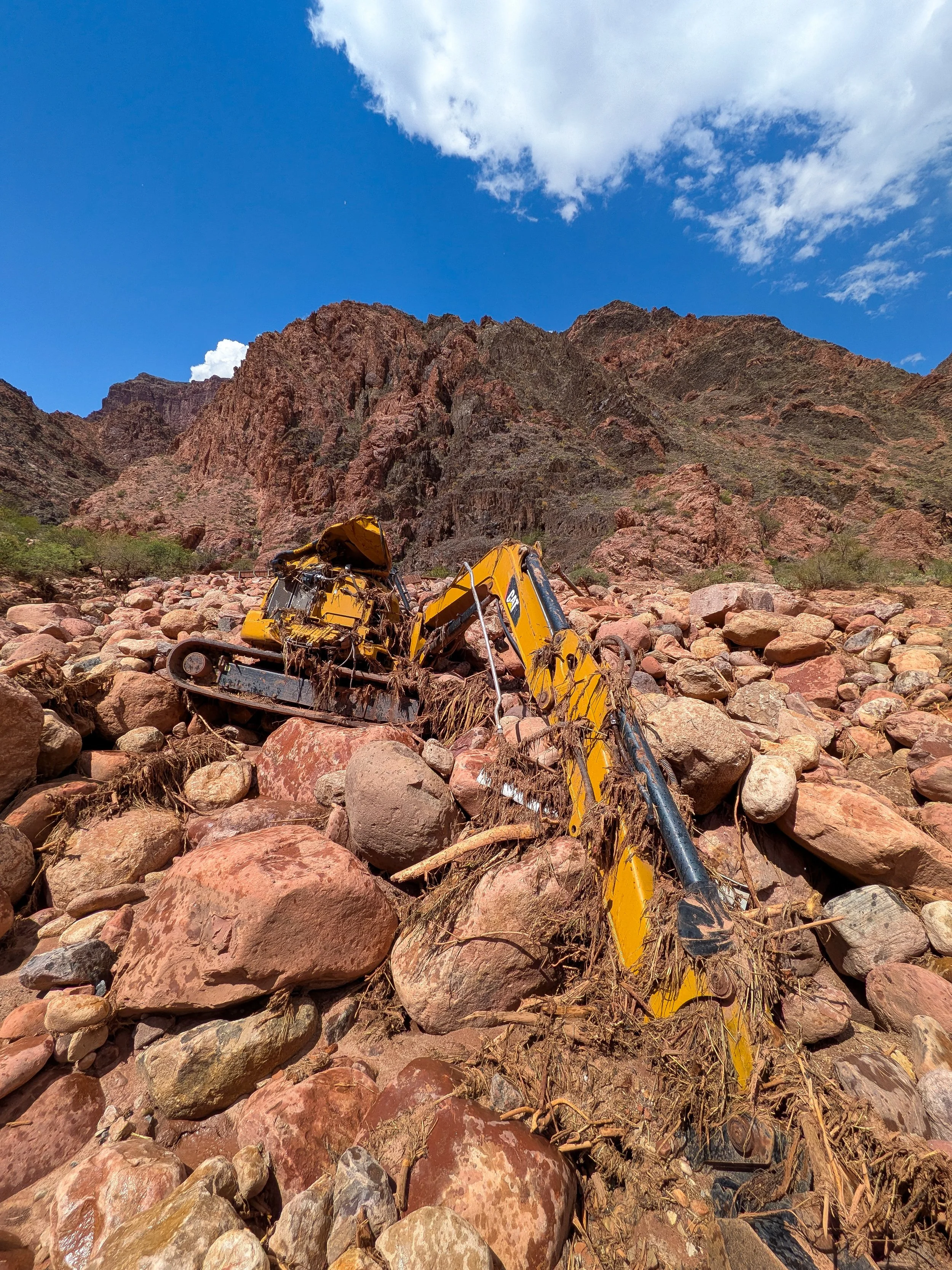
We did see debris and trash floating in the river for another 100 miles downstream. There was a big metal piece of debris in Horn Creek, just below Phantom and a new boulder was at the bottom of Crystal, which must have moved from the Bright Angel Creek flood. We saw styrofoam, wooden planks, construction material, metal poles, and dead fish on beaches and floating in eddies. Just above Hermit Rapid, we found a fridge on a beach that had ice cream sandwiches and a Kirkland pork tenderloin that must have floated down from Phantom.
We learned that we were likely the third party to have ever run the new rapid, historic! Ever since the construction of Glen Canyon Dam, it’s been rare for a flood in Grand Canyon to be big enough to create a new rapid. While all of this made for just a weird experience, what was really strange to me was being on the other end of a news headline, where you’re really living it and dealing with the consequences of a natural disaster, instead of reading about it online and watching the videos of the devastation on Instagram. While the destruction of the historic buildings of Phantom Ranch, in a beloved National Park, with missing people, and people who ended up being killed is a serious event, it still felt to me like the news and the internet machine sensationalized it all. It’s hard to explain.
Passing Phantom Ranch and knowing that there were missing people, with scared families and friends up on the Rim, certainly left a mood among our trip members for a few days. It was gloomy, but all the while, we were still in Grand Canyon and we were on a mission. We held the missing people, impacted families, and NPS rangers in our hearts, and kept on downstream.
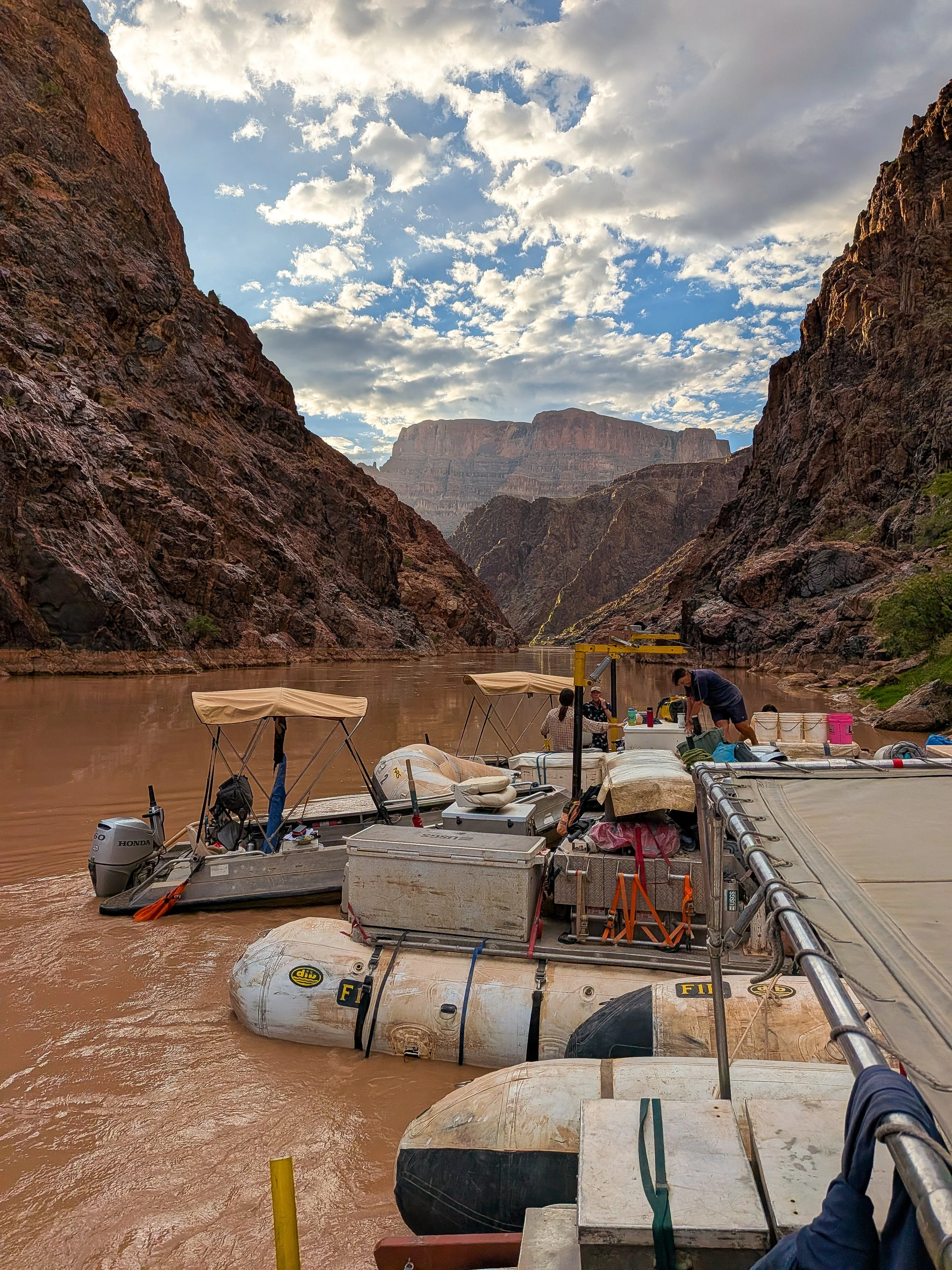
Boats parked in the Lower Granite Gorge.